Takenga − Background
Large vessels can sail between Motiti Island and the Astrolabe Reef exclusion zone to shorten travel time to and from the Port of Tauranga. However, this can bring them dangerously close to Motiti Island and the reefs. For example, on 21 March 2024, a cargo vessel heading to the Port of Tauranga passed approximately 500–800 metres from shore when transiting this passage. Subsequently, a Harbourmaster direction was issued on 9 May 2025, prohibiting vessels greater than 500 gross tonnes from transiting the following exclusion zone:
Motiti Island: a circle of 2.0 nautical miles centred on position 37 36.430 South, 176 25.135 East (i.e. the Motiti Island beacon).
This zone overlaps with the existing exclusion zones around Astrolabe Reef, Brewis Shoal, and O Karapu Reef, preventing large ships from navigating between these areas and Motiti Island.
Why is there a need for a maritime exclusion zone in this area?
Large ships have limited ability to manoeuvre due to their size, momentum and draft (how deep they sit in the water), which means there is a higher risk of collision or running aground if they transit through this treacherous area. While such incidents are rare, their consequences can be catastrophic – environmentally, socially and economically. Many locals will recall the MV Rena grounding on Astrolabe Reef in 2011, and the devastating impact the oil spill and container debris had on the coastal environment and sea life.
Who will the exclusion impact?
This proposed exclusion zone will only apply to vessels over 500 gross tonnes. Smaller vessels will still be able to use the area.
How is the exclusion zone different from the rules of the Motiti Protection Area?
The Motiti Protection Area (MPA) was established following a 2020 Environment Court decision, aimed at protecting the biodiversity, cultural heritage and landscape of three offshore reef systems near Motiti Island. The MPA prohibits the taking of marine life and restricts anchoring to protect reef habitats. (See here for further information on the MPA)
In contrast, the proposed exclusion zone is focused on maritime safety. It aims to reduce the risk of large vessels running aground by preventing them from transiting between Motiti Island and nearby reef exclusion zones.
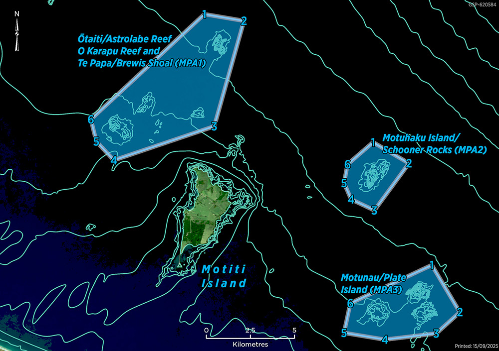
Map showing the Motiti Protection Area
Why don’t you just keep the existing Harbourmaster direction in place indefinitely?
Under Maritime New Zealand regulations, Harbourmaster directions must have an expiry date. The current direction is set to end on 1 November 2025. While short-term extensions are possible, a permanent solution requires a formal amendment to the Bylaw.
Got more questions?
Check out our Frequently Asked Questions document. You can also contact us via email: navsafety@boprc.govt.nz


